Thurs 17 August Living Streets held a walk of the streets around the Museum of London as a demonstration of ‘psychogeography’, how we feel in a place, do we feel safe, is it an environment you want to be in?
Up on the high-rise walkway with space dedicated to pedestrians it was easy to feel safe and distant from the traffic below. We were asked to take note of how we felt when the open walkway became enclosed with no outlook. The way-finding signs for the Barbican were well placed on the high rise section above the street so that people could find where they were going.

Back down at street level it was difficult to be heard with the busy traffic passing by, not a pleasant environment to be in for any length of time.

Just around the corner however on the same road was a hedge sheltering a small graveyard, now park, which provides a pleasant spot to sit away for a while. The hedge not only made a very noticeable difference to the noise of the traffic but it was pointed out that by screening the vehicles passing by, it also had a psychological effect and provided a calmer environment. The greenery also helps to mitigate the effects of air pollution capturing some of the sticky particulate matter rather than us breathing this in to our lungs, and of course absorbing CO2 and making O2. An all-round good solution.
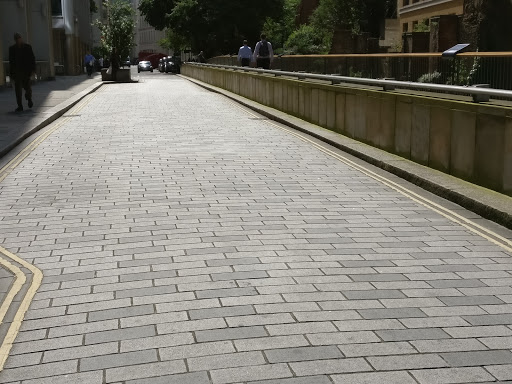
Heading down Noble Street this road ran alongside the old London Wall and had been paved with a different brick. There were bollards at one end for cyclists to pass, and double yellow lines to stop other traffic parking. As a mixed use road for cars, bikes and pedestrians you felt as safe walking down the middle of the as down the dedicated path on the side. The road markings give conflicting messages about whether the space is for pedestrians or not – on the one hand, the ‘shared space’ surface and bollards suggest vehicles are restricted but on the other hand, double yellow lines and crash barrier suggest that it’s still a road. Shared space principles make it safe to walk down the middle but majority of people we observed still walked along the pavement.

Here is a pic of the old London Wall built by the Romans around to protect Londinium in the 2nd or 3rd century.
At the end of this road we observed the position of the dropped kerbs on the pavement. Rather than providing safe options for those in wheelchairs they led down on the to busy Gresham Street so this something that could to be altered. The dropped kerbs at the end of Noble Street restrict people with limited mobility from crossing Gresham Street as there aren’t any that allow a crossing there. The only crossing point is at the end of Gresham Street (shown in photo below) and the junction has been narrowed to reduce vehicle speeds entering Gresham Street here making it a fairly safe crossing.
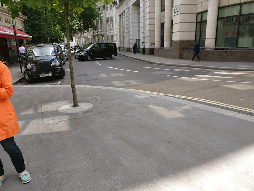
At this point in the road a raised table also signals for drivers to slow down as does a tree planted on the corner of the road. This is an example of how road planners can contribute to reducing speeds on certain roads.

Passing St Botolph’s Without Aldersgate Church (great name), along Little Britain, offices now backed on to this narrow road with air conditioning pumping out and it was noted as a street that people would not spend time on.

Back on the roundabout we were shown railings on the side of the road which are intended to improve pedestrian safety but actually don’t contribute in a positive way to feeling safe on the pavement. This guard railing implies a car-lead street rather than one used by pedestrians.
We looked again at the way-finding to the museum from this point, the building was visible at the top of the roundabout but it wasn’t easy to identify how to get up there and where the steps were to the upper walkway.
This was a really interesting well-structured walk to demonstrate how our streets can be made safer and more people-friendly places to spend time.
Many thanks to Margaret for the photos and to Google for the first.
